
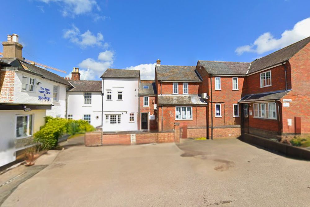
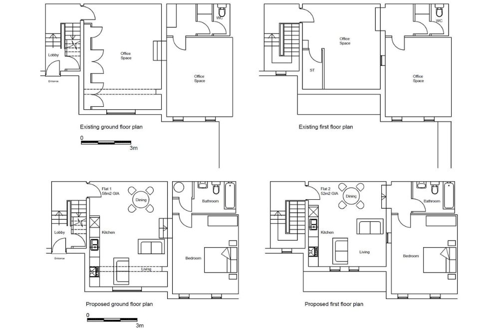
We were commissioned to undertake a Heritage Impact Assessment to address proposals for the redevelopment of our client’s site in Hemel Hempstead, that comprised the conversion of an office space into two residential apartments.
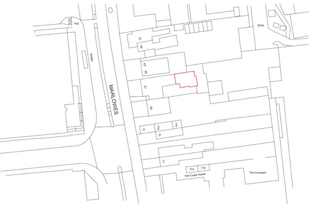
The application site is located to the rear of a Grade II listed building, first designated in 1977. It was built before 1873 and is therefore considered a part of the designation by virtue of this physical attachment. As the application site is attached to this listed building, it’s also considered curtilage listed.
Hemel Hempstead is located 7km west of the Roman settlement of Verulamium (St. Albans) and given the high-quality of the agricultural land of the hinterland, this area would have been densely settled during that period.
Whilst archaeological finds point to a continuous series of human activity from the Roman period through to the early Saxon period, the settlement is first recorded in the 8th century when Offa, the King of Wessex, granted land at ‘Hamaele’ to the Bishop of London in 705. The settlement was known as ‘Henamsted’ in the Saxon period which became known as ‘Hemel-Amstede’ by the 11th century. It is commonly thought that ‘Haemele’ refers to the individual that originally owned the land in the 8th century, whilst ‘Hemstead’ is likely derived from a Saxon placename for ‘homestead’.
The settlement was subsequently recorded in the Domesday Book of 1086 as a vill named ‘Hamelhamstede’, with around 100 inhabitants and a large manor assessed at 10 hides including four mills.
Larger residences were built during the 18th and 19th centuries, and the town began to gradually expand. The town benefitted from being on the shortest route between London and the industrial Midlands, which also benefitted from transport links provided by the Grand Junction Canal and the London and Birmingham Railway.
After the Second World War the town changed dramatically. It was designated a ‘New Town’, to provide housing for displaced London residents following the clearance of slums and bombsites.
Whilst there is little history available on the local authority planning register for Marlowes Court, it appears to have remained in office use for most of its history. In 2001, an application was granted for its conversion to residential use, however, an application was withdrawn for similar proposals in 2008.
We were commissioned to undertake a Heritage Impact Assessment to address proposals for the redevelopment of our client’s site in Hemel Hempstead, that comprised the conversion of an office space into two residential apartments.
The application site is located to the rear of a Grade II listed building, first designated in 1977. It was built before 1873 and is therefore considered a part of the designation by virtue of this physical attachment. As the application site is attached to this listed building, it’s also considered curtilage listed.
Hemel Hempstead is located 7km west of the Roman settlement of Verulamium (St. Albans) and given the high-quality of the agricultural land of the hinterland, this area would have been densely settled during that period.
Whilst archaeological finds point to a continuous series of human activity from the Roman period through to the early Saxon period, the settlement is first recorded in the 8th century when Offa, the King of Wessex, granted land at ‘Hamaele’ to the Bishop of London in 705. The settlement was known as ‘Henamsted’ in the Saxon period which became known as ‘Hemel-Amstede’ by the 11th century. It is commonly thought that ‘Haemele’ refers to the individual that originally owned the land in the 8th century, whilst ‘Hemstead’ is likely derived from a Saxon placename for ‘homestead’.
The settlement was subsequently recorded in the Domesday Book of 1086 as a vill named ‘Hamelhamstede’, with around 100 inhabitants and a large manor assessed at 10 hides including four mills.
Larger residences were built during the 18th and 19th centuries, and the town began to gradually expand. The town benefitted from being on the shortest route between London and the industrial Midlands, which also benefitted from transport links provided by the Grand Junction Canal and the London and Birmingham Railway.
After the Second World War the town changed dramatically. It was designated a ‘New Town’, to provide housing for displaced London residents following the clearance of slums and bombsites.
Whilst there is little history available on the local authority planning register for Marlowes Court, it appears to have remained in office use for most of its history. In 2001, an application was granted for its conversion to residential use, however, an application was withdrawn for similar proposals in 2008.