
Burgess Hill’s origins trace back to the ancient Saxon parishes of Clayton and Keymer, both recorded in the Domesday Book. Although prehistoric evidence is limited, the north–south London to Hassocks road dates to the Roman period. The name “Burgess Hill” likely derives from the Burgeys family, taxed in the area during the late 13th and early 14th centuries. A key medieval event was St. John’s Sheep Fair, held annually from the 14th century until 1912. During this time, the landscape was largely agricultural, with numerous historic farmhouses such as Chapel Land (c.1480), Hammonds Place (1565), and Grove Farmhouse (c.1600), reflecting Tudor and early post-medieval rural life.
The 17th century saw the introduction of brick and tile manufacturing and an increase in smallholdings as land was granted to settlers. By the 18th century, small shops, alehouses, and crafts like blacksmithing and weaving appeared near St. John’s Common. The enclosure of the Common (1828–1855) and the arrival of the London, Brighton & South Coast Railway (1838–1841) catalyzed Burgess Hill’s transformation into a town. By 1880, its population reached 4,500, supported by churches, shops, and middle-class homes alongside workers’ cottages.
The late 19th and early 20th centuries brought further expansion, with a new railway station (1889) and attractions like the Victoria Pleasure Gardens (opened 1897). After World War II, Burgess Hill underwent rapid growth—its population doubling between 1951 and 1961 to 14,000.
Industrial estates emerged where the Pleasure Gardens once stood, while new residential zones spread westward. By the 1990s, infrastructure such as the Martlets Shopping Centre, Jane Murray Way, and the Triangle Leisure Centre (1999) reflected continued modernization, with the population reaching around 28,000.
The Silverdale Road/Birchwood Grove Road Conservation Area, designated in 1982, preserves much of the town’s late Victorian and Edwardian character. Large detached houses with clay-tiled roofs, brick façades, gables, and mature gardens remain prominent. Despite later infill and redevelopment, the area retains its semi-rural charm, with tree-lined roads and secluded properties that soften urbanization. Within this setting, the application site—Hilgay Cottage—lies behind Acorns on Birchwood Grove Road. Likely once part of the grander Hilgay estate, it reflects the layered architectural and social history that defines Burgess Hill’s development from Saxon farmland to thriving modern town.
Burgess Hill’s origins trace back to the ancient Saxon parishes of Clayton and Keymer, both recorded in the Domesday Book. Although prehistoric evidence is limited, the north–south London to Hassocks road dates to the Roman period. The name “Burgess Hill” likely derives from the Burgeys family, taxed in the area during the late 13th and early 14th centuries. A key medieval event was St. John’s Sheep Fair, held annually from the 14th century until 1912. During this time, the landscape was largely agricultural, with numerous historic farmhouses such as Chapel Land (c.1480), Hammonds Place (1565), and Grove Farmhouse (c.1600), reflecting Tudor and early post-medieval rural life.
The 17th century saw the introduction of brick and tile manufacturing and an increase in smallholdings as land was granted to settlers. By the 18th century, small shops, alehouses, and crafts like blacksmithing and weaving appeared near St. John’s Common. The enclosure of the Common (1828–1855) and the arrival of the London, Brighton & South Coast Railway (1838–1841) catalyzed Burgess Hill’s transformation into a town. By 1880, its population reached 4,500, supported by churches, shops, and middle-class homes alongside workers’ cottages.
The late 19th and early 20th centuries brought further expansion, with a new railway station (1889) and attractions like the Victoria Pleasure Gardens (opened 1897). After World War II, Burgess Hill underwent rapid growth—its population doubling between 1951 and 1961 to 14,000.
Industrial estates emerged where the Pleasure Gardens once stood, while new residential zones spread westward. By the 1990s, infrastructure such as the Martlets Shopping Centre, Jane Murray Way, and the Triangle Leisure Centre (1999) reflected continued modernization, with the population reaching around 28,000.
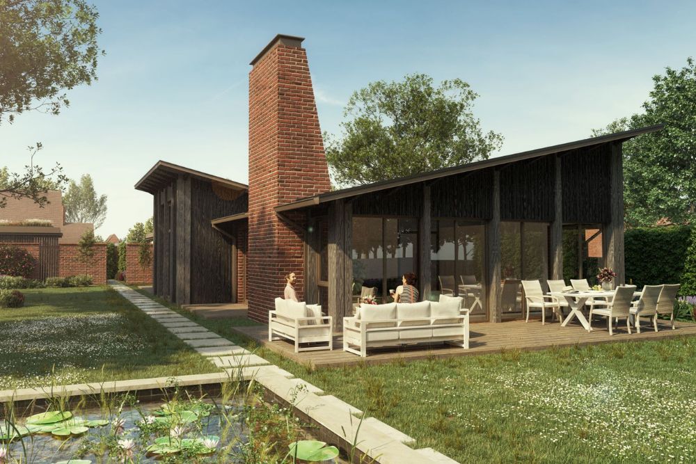
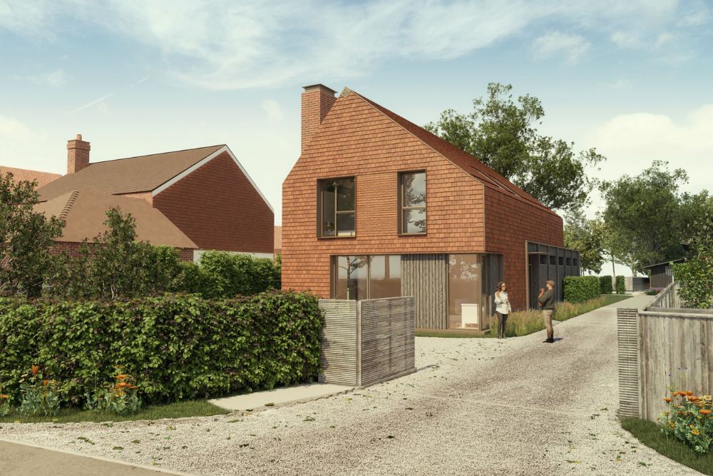
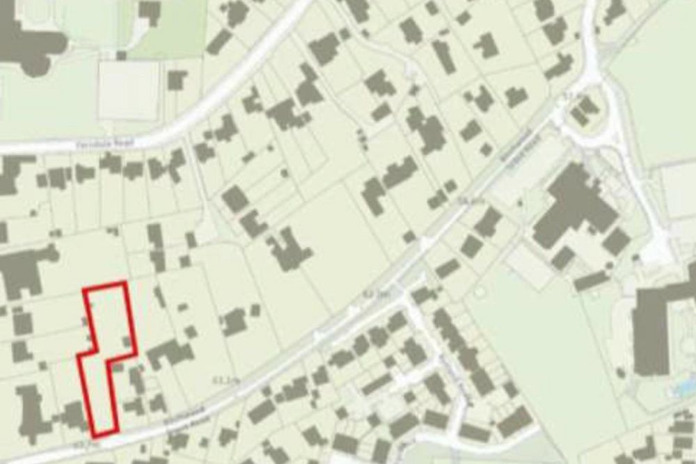
The Silverdale Road/Birchwood Grove Road Conservation Area, designated in 1982, preserves much of the town’s late Victorian and Edwardian character. Large detached houses with clay-tiled roofs, brick façades, gables, and mature gardens remain prominent. Despite later infill and redevelopment, the area retains its semi-rural charm, with tree-lined roads and secluded properties that soften urbanization. Within this setting, the application site—Hilgay Cottage—lies behind Acorns on Birchwood Grove Road. Likely once part of the grander Hilgay estate, it reflects the layered architectural and social history that defines Burgess Hill’s development from Saxon farmland to thriving modern town.